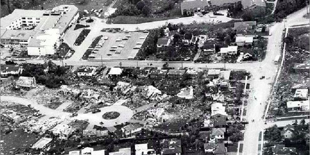
On May 31, 1985, one of the deadliest tornadoes in Canadian history tore through Barrie, leaving a trail of devastation and marking a turning point in how we prepare for severe weather. Four decades later, meteorologists are still learning from that day — and working to keep the public better informed and prepared.
Geoff Coulson, an Emergency Preparedness Meteorologist with Environment Canada, remembers that day well.
“I was actually on a day off,” he said in a recent interview. “Noticed some very, very dark skies to the north of Mississauga where I was living at the time and only found out later the next day at work just how terrible that day had actually been.”
The 1985 Barrie tornado claimed eight lives and caused over $100 million in damage. The twister was classified as an EF4, with winds of up to 400 km/h. At the time, Canada's radar systems were still relatively basic, and the ability to forecast and track tornadoes was limited. Since then, the science has made leaps — but challenges remain. “The forecasting of tornadoes continues to be one of the most challenging jobs a weather forecaster faces anywhere in the world,” Coulson explained.
From Black-and-White Radar to Dual-Polarization
Since 1985, Environment Canada has moved from conventional radar to Doppler, and more recently, to dual-polarization radar. This newer technology offers more precise data on storm structure and severity, helping forecasters identify potentially tornado-producing systems faster and with greater accuracy.
Still, warning the public in time is not always possible.
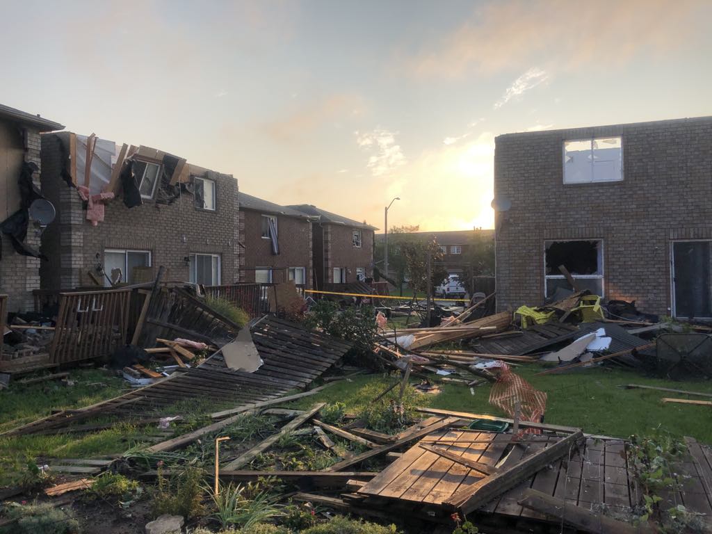
During the 2021 Barrie tornado — a destructive EF-2 storm — “warnings were issued, but unfortunately with very little or no lead time for the areas initially impacted,” Coulson noted.
Why Warnings Don’t Always Come in Time
On severe weather days, Environment Canada issues a range of alerts: watches, which signal the potential for storm development, and warnings, which are issued when a storm is either imminent or already occurring.
But some storms form and move so rapidly that even the best forecasting tools can't always provide much lead time. “It’s really understanding the full breadth of the alerts,” said Coulson. “Even in the initial stages when severe thunderstorm watches go out, some of these storms can form and move so quickly that the warning that may follow may not again provide a lot of lead time.”
Is Barrie in Ontario’s Tornado Alley?
Southern Ontario — particularly the Windsor-London-Kitchener-Barrie corridor — has long been considered Canada’s version of Tornado Alley. But recent research suggests the most active zone may be shifting.
The Northern Tornadoes Project, based out of Western University, is finding more tornado activity east of Lake Simcoe, into the Kawartha Lakes, Haliburton, and even the Ottawa Valley. “One of the hypotheses is that there’s been a bit of a shift eastwards in where some of these more active storms are occurring,” Coulson said. “But we need more data to understand these trends better.”
What You Can Do: Be Weather Aware
While meteorologists continue to improve tornado detection and response, public awareness remains a critical piece of the safety puzzle. Smartphones — a tool unavailable in 1985 — now play a huge role.
Apps like WeatherCAN deliver real-time alerts directly from Environment Canada, giving users precious minutes to seek shelter.
“Learning what the safety things are to be doing in these situations, given the fact that these storms can move so quickly,” said Coulson, “is essential.”
The tornado season in Ontario typically runs from early May to late June, but as recent years have shown, storms can strike outside that window.
The next time you see a watch or warning pop up on your phone, Coulson urges you don’t dismiss it. Take a moment to review your emergency plan, check your surroundings — and stay weather aware.