Updated February 16, 2025 @ 12:32pm
UPDATE (Sunday, 12:30 p.m.):
Environment Canada's winter storm warning remains Sunday morning for much of southern Ontario including Barrie, Orillia, Simcoe County, and surrounding regions.
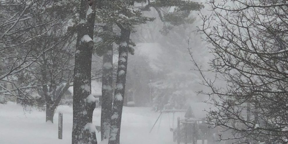
The agency still predicts 15 to 25 cm of additional snowfall today, with the heaviest expected this morning.
They continue to say that "conditions will rapidly deteriorate this morning as a more significant area of snow and blowing snow arrives," and that "travel will be hazardous and is not recommended."
Officials added that the winter storm warning should end this evening.
But, a snow squall watch was also issued for Barrie, Orillia, and Simcoe County this morning by Environment Canada.
"Snow squalls are expected to quickly develop off of Lake Huron and Georgian Bay in the wake of this weekend's winter storm," the agency stated.
The watch is expected to start this evening and continue through Tuesday.
"Total snowfall accumulations of 30 to 60 cm. The highest amounts are possible if a snow squall remains stationary over a given location. Near zero visibility in heavy snow and blowing snow," they added.
On Saturday night and Sunday morning, the District of Muskoka, the Township of Springwater, and the Township of Tiny declared significant weather events for their areas.
"It may take longer than usual to bring the roads back to optimal conditions," Springwater Township officials wrote in a release. "Residents are asked to avoid unnecessary travel at this time."
Track the latest with the Barrie 360 Storm Watch page: https://barrie360.com/storm-watch/
Environment Canada has issued warnings for southern Ontario about a "highly impactful" winter storm that will last until Sunday evening.
It was a snowy Saturday, but this was the appetizer on the storm menu with the main course to begin Sunday morning.
"Conditions will rapidly deteriorate Sunday morning as a more significant area of snow and blowing snow arrives. An additional 15 to 25 cm is likely. Travel will be hazardous and is not recommended, particularly on Sunday," the weather agency noted.
Wind gusts to 60 km/h will blow the snow around, resulting in poor to zero visibility at times.
Once the storm moves off, Environment Canada says snow squalls will fire up to the lee of Lake Huron and Georgian Bay Sunday night through Monday.
The winter storm that hit Barrie overnight Wednesday into Thursday this past week dumped between 20 and 25 cm of snow.
Track the latest with the Barrie 360 Storm Watch page: https://barrie360.com/storm-watch/