Scientists say tiny grains of sand from the Sahara Desert are to blame for the almost month-long lull in this year's Atlantic hurricane season. But it could soon come to an end.
Every June and July, there is a peak in the amount of dust from the North African desert lifted high above the North Atlantic by strong winds, disrupting the formation of tropical storms.
This annual phenomenon, known as the Sahara Air Layer (SAL), hurled an unusually large amount of sand into the upper atmosphere earlier this month, according to NASA.
"You can see it in the atmosphere, moving from Africa eastward across the Atlantic," says Chris Fogarty, manager of the Canadian Hurricane Centre in Dartmouth, N.S. "Hurricanes are not likely to form when you've got a lot of this dry air from the desert in it."
The dry air prevents the buildup of tall clouds that are needed to form a hurricane. As well, the SAL creates a temperature inversion, which means a layer of warm air remains over colder air, causing clouds to spread out rather than rise to form thunderstorms. And the strong winds that carry the layer along cause wind shear, which can tear storms apart.
Barrie's News Delivered To Your Inbox
By submitting this form, you are consenting to receive marketing emails from: Central Ontario Broadcasting, 431 Huronia Rd, Barrie, Ontario, CA, https://www.cobroadcasting.com. You can revoke your consent to receive emails at any time by using the SafeUnsubscribe® link, found at the bottom of every email. Emails are serviced by Constant Contact
Only three named storms have formed over the Atlantic since hurricane season started on June 1 — tropical storms Alberto and Chris, and hurricane Beryl, which on July 2 became the earliest Category 5 hurricane to be recorded over the Atlantic.
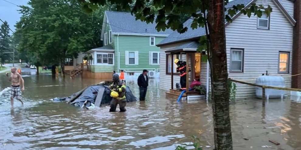
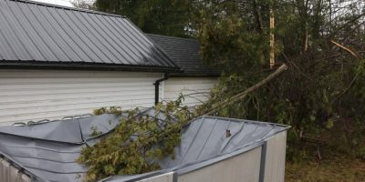
On July 11, post-tropical remnants from Beryl were blamed for dumping more than 100 millimetres of rain on Wolfville, N.S., where a 13-year-old boy died when he was overwhelmed by floodwaters in a drainage ditch. That deadly event served as a telling reminder of what tropical storms are capable of, but the weather over the Atlantic has been noticeably quiet since then.
Fogarty, however, said hurricane season is sure to pick up in the weeks ahead, with the peak of the season typically arriving in the first few weeks of September.
"Whenever there's a period of quiet activity in the atmosphere, whether it's tropical storms or winter storms, usually that means there's energy building up somewhere in the ocean atmosphere system," he said, adding that with no strong winds stirring up the Atlantic, its surface temperatures will continue to rise — a key source of energy for hurricanes.
Fogarty said now is the time for people in Eastern Canada to prepare for strong winds, heavy rain and storm surges. "It's been quiet for a period and you can be lulled into complacency," he said. "Let's not wait until these storms are in the news."
In late May, the Canadian Hurricane Centre predicted an active hurricane season fuelled by record-high ocean temperatures.
At the time, the National Oceanic and Atmospheric Administration in the United States predicted 17 to 25 named storms with eight to 13 of those becoming hurricanes, and four to seven becoming major hurricanes.
Typically, about 35 per cent of the storms that form in the Atlantic Basin travel to Canadian waters, but in any given year that average can vary wildly.
Last year, American forecasters called for 12 to 17 named storms, five to nine hurricanes and one to four major hurricanes; in reality, there were 20 named storms, seven hurricanes and three major hurricanes.
Five of those storms entered Canadian waters, but little damage was reported. Post-tropical storm Lee, the only storm worthy of note, downed trees and caused some storm surge damage and power outages along the southern coasts of Nova Scotia and New Brunswick.


