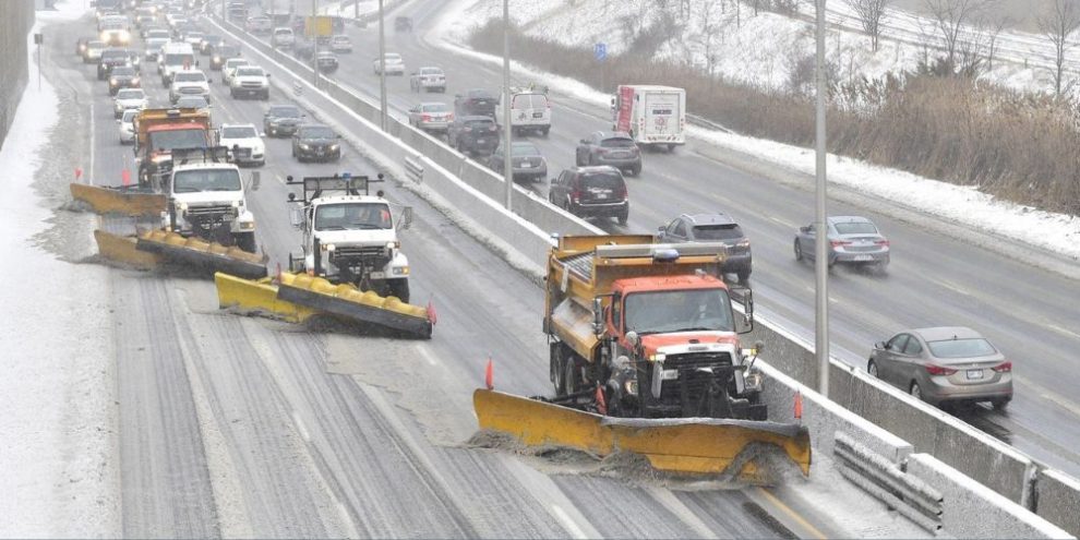
Old Man Winter doled out a medley of punishment across Canada on Wednesday as freezing rain encased southern Ontario, cold and snow swept across the Prairies, and heavy snow blanketed the East Coast.
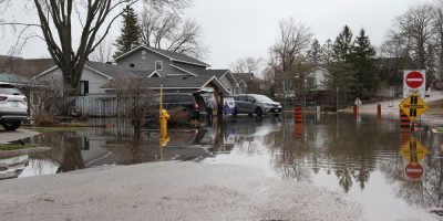
In southwestern Ontario, strong winds and ice buildup from freezing rain raised the possibility of local power outages and downed trees. Hydro One, the provincial utility, said it was monitoring the storm and its crews were ready to respond.
The utility reported outages that had knocked out power to roughly 5,000 customers as of late Wednesday afternoon, though it was unclear how many of those were weather-related.
The wet weather arrived after a recent stretch of mild temperatures and melting snow, prompting some conservation authorities to warn of possible flooding.
School buses were cancelled across the Greater Toronto Area, where the forecast called for a mix of freezing rain, ice pellets and snow that could make for a slippery commute. The Hamilton-Wentworth District School Board closed its schools for the day.
Four elementary-aged children were sent to hospital with minor injuries when their school bus crashed into a ditch in Oxford County, between London and Hamilton. Ontario Provincial Police said the weather was likely a factor and noted the road was ice-covered. The region was at the western edge of an area under a freezing rain warning.
In a 3:30 p.m. update, police said there had been about 160 crashes since about 5 a.m. across the Greater Toronto and Hamilton area.
Later in the day, Waterloo regional police said a bus hit a house in Cambridge, with weather and slippery road conditions factoring into the crash. They said the driver of a Grand River Transit bus lost control, left the roadway and hit the house. Police said two passengers were on the bus at the time, but no injuries were reported.
Across Barrie and Ontario's cottage country, Environment Canada said around 10 to 15 centimetres of snow was possible, with ice pellets at times, and snowfall totals expected to drop off sharply to the east toward Kingston. Northern Ontario was not spared either, with Thunder Bay expected to see about 20 to 40 centimetres of snow, and possibly more in some areas.
Elsewhere in Canada, Environment Canada was tracking a cold, windy weather system from the Northwest Territories and through the Prairies.
Yellowknife woke up to dense fog and a cold warning with winds expected to make it feel like close to -50 C in the area. A similar warning was in place across northern Alberta.
Cold warnings dotted the country elsewhere too, including Nunavut and British Columbia's north coast.
From central Saskatchewan to southern Manitoba, the forecast shifted to blowing snow. Roughly 25 to 35 cm of snow was expected in the hardest-hit areas, with gusting winds of 80 kilometres per hour.
Both the cold and the snow were expected to linger until early Thursday morning.
On the East Coast, Newfoundland's Avalon Peninsula was hammered by snow. The St. John's area had seen about 35 and 55 centimetres fall by Wednesday evening, with Environment Canada calling for another 10 to 20 centimetres into Thursday morning.
Many flights were cancelled at the St. John's International Airport on Wednesday, and schools were closed for the day in much of eastern Newfoundland.
This report by The Canadian Press was first published Feb. 18, 2026.