Files from Barrie 360
By Fakiha Baig
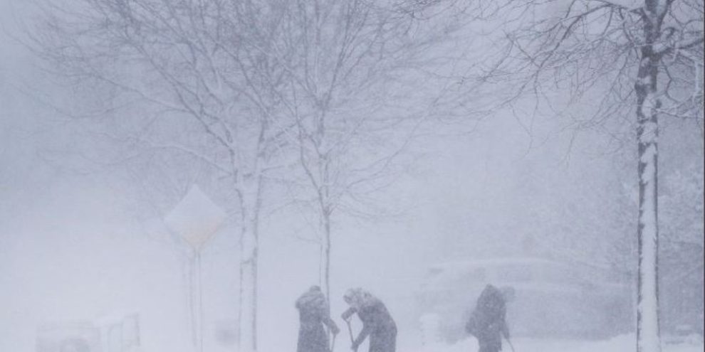
A winter storm bringing a messy mix of rain, ice pellets and snow to much of southern Ontario arrived a little earlier than expected on Wednesday, with Environment Canada warning that heavier snow and colder temperatures were set to follow.
Weather warnings were in place for most of southern Ontario as a storm system from the northern plains of the United States travelled to southwest Ontario, was set to spread across the Greater Toronto Area and later was expected to hit the Ottawa region, said Geoff Coulson, a meteorologist with Environment Canada.
"This is going to be a long storm system that really gets going (Wednesday) afternoon and continues overnight," said Coulson.
"On Thursday, we're expecting a second shot of precipitation possibly moving through that could give more freezing drizzle, freezing rain, ice pellets and snow to various parts of southern and eastern Ontario."
The Barrie area is expecting a mixture of snow and ice pellets beginning Wednesday evening and continuing overnight before the precipitation becomes less intense on Thursday. Between 15 and 25 cm of snow or ice pellets is expected, while in areas to the north from Orillia and Midland to Muskoka, it will be mostly a snow event, and again some places could get 20 cm.
By Thursday, Environment Canada said the storm system is expected to bring up to 20 millimetres of ice buildup in the southwest, such as the London and Niagara areas, which may also cause extensive power outages.
Up to 15 centimetres of snow and ice is in the forecast for the Greater Toronto Area, and up to 20 centimetres of snow may fall in the Ottawa area, the weather agency said.
"In the wake of the storm is conditions turning colder," Coulson said.
"We're actually looking at Friday being colder than normal in many areas and still being on the chilly side on Saturday. But then Sunday, in many areas, we'll see temperatures back to milder than normal conditions."
Environment Canada is warning highways, roads, walkways and parking lots across the province will become icy and hazardous so residents should take special care.
Coulson said parts of northern Ontario are not being hit by the snow system but are under extreme cold warnings.
"That cold is expected to continue at least into Saturday in many areas and then the north will also see temperatures become moderate as well," he said.
A spokesperson for the Greater Toronto Airports Authority said Toronto's Pearson International Airport has prepared for the storm and has extra staff on standby.
"Winter weather is a reality of life in Canada, and just as any number of services may be affected across the province of Ontario, passengers should be aware that the storm may impact their travel plans into and out of Pearson," said Ryan White.
Pearson airport said on its website that some flights from the United States to Ontario were delayed Wednesday afternoon. The airport is asking travelers to keep an eye on the status of their flights before they leave their homes.
Hydro One said it is prepared to respond to power outages resulting from the storm.
"We're getting our crews and support staff in position to respond to any outages caused by this potentially damaging ice storm," spokesperson Chong Kiat Ng wrote in a statement.
In Toronto, the city's transit operator said it was also preparing for the storm.
"The TTC will mobilize additional operators and vehicles to ensure minimal impact for customers," it wrote in a statement. "Those who need to travel during this snow event are encouraged to use transit to get to their destination safely and reliably."
Coulson, of Environment Canada, said this is the second major blast of winter the province is seeing since a winter storm hit Ontario around Christmas.
"There's actually been a few other snowfalls between those two events but certainly (these two storms) bookend the winter so far," he said.
The main difference between the two storms is that this one is accompanied by more mild temperatures. But Coulson said that means the latest storm will result in messier roads.
"We still got a fair amount of winter left to go where there could be more storms like this as we finish off February and head into the month of March," he added.
Coulson said the "bounce back" to milder temperatures that were seen in southern Ontario over the weekend has become the theme for this winter season.
"It has been a milder than normal winter for much of the province of Ontario overall," he said.
"I believe back in 2015 (or) 2016, we had a number of winter months that were milder than normal so it's not unheard of for something like this to happen, but certainly it only happens from time to time."
Last week on Feb. 15, for example, he said the province broke a record set in 1954 when temperatures rose to about 14 C.
"The old record 12.2 C," he said.
Banner image: THE CANADIAN PRESS/Nathan Denette
This report by The Canadian Press was first published Feb. 22, 2023.